
Hiking In Taiwan: Pingxi District (平溪)
I've lived in Taiwan for a little over a year now, and as we are getting ready to pack up and move to South Korea next month, I wanted to document and share some of my favorite places I've visited. Hopefully this will be helpful to anyone else who happens to make it out to this great country and it will also help avoid the headache of having to find some of these places like I did.
I love being outdoors, and Taiwan is heaven when it comes to an abundance of unique and challenging hikes. The same aspects that attract me to cycling have also recently drawn me to an increased desire to hike and be in the mountains, forests and wildernesses. As we (as a society) develop and create new means of travel and enhance the technologies that assist us to reach our destinations we are significantly reducing the time it takes to travel from Point A to B. But I still advocate for taking the long road. I feel that part of the destination is the journey you take to get there, and given the option my vehicle of choice is more often my bicycle or my own two feet. These human-powered modes of transportation allow for a much more immersed experience. They are quiet so you can not only see your surroundings, you can hear them, and because there is nothing between you and the air you can feel, taste and smell them too.
Located about 30 mins outside of Taipei, Taiwan is the rural district of Pingxi (平溪). Although it's most famous for it's yearly lantern festival, this is also the location of one of my favorite hiking areas in Taiwan. What attracts me to this place is not only the beautiful lush landscape, but the thrilling ridges and crags that are to be explored in this area.

Coming down of the summit of Mt. Putuo. One of the famous Pingxi Crags.
BEFORE YOU GO
I will say this hike is not for the faint of heart. For those who are scared of heights or are proclaimed vertigo sufferers there are a few sections that can be a little sketchy. However, you are not required by any means to climb to the peak of each trail as most are an out and back kind of thing. That being said it can still be a fun day out for all levels of adventure seekers. Most of the trails here are actually steps carved into the rock faces, so be prepared to to do a lot of climbing, it can be quite a workout if you keep a decent pace as you climb higher out of the forests. When I hiked Pingxi (平溪) it had rained a little bit in the morning and the areas under the tree cover were still damp. I will say these trails can get pretty slick when it's wet, so make sure you bring appropriate shoes or hiking boots.
GETTING THERE
Getting to Pingxi (平溪) is quite easy if you have a car, but almost equally as easy if you don't as there is a train station right in town in which buses and trains run to for most of the day. If you want to take the scenic route, I would suggest taking the train which actually loops around and enters Pingxi (平溪) from the East. For directions and train/bus routes to the Pingxi Station, simply search for it in Google Maps, but just for fun here is a quick breakdown of the steps...
Head to Taipei Main Train Station.
Buy a ticket to Ruifang Train Station - it will set you back about 48NTD
At Ruifang exit the station to the ticket counter outside the gate and buy a ticket to Pingxi - This was under 100NTD
The ticket for the Pingxi train is all day, so you can pretty much get off at any of the stops and get back on to explore the sites along the way.
Once you are in Pingxi (平溪) the trail head starts less than 0.5km from the station and I've done my best to pin the exact starting location in the map below.
THE HIKE & TRAIL MAP
I only had time to really explore the famous crags. Rumor has it these steps were hand-carved into the mountain faces by the retired bodyguard of Chiang Kai Shek (the leader of the Republic of China from 1928-1975). With the time I took snapping a couple pictures and enjoying the views it took me around 2.5 hours to hike up and down the 3 main crags near the trail head. Unfortunately I didn't have time to do the back half of the trail network which goes up over Zhongyang Peak. But I had a ton of fun during my trip, and I would highly recommend spending a day out here. It can be quite thrilling hiking up the faces of the crags, and the views are just phenomenal. I would say the only complaint I had about this hike is that the forest is littered with lanterns that are constantly being launched from the Township. It seems to be a year long attraction these days.

The Pingxi District Trail Map
A FEW PHOTOGRAPHS
I'm hoping to upload a slew of images to my flickr account when I have time to go back and edit them all, but for now here are a couple of great images showing the uniqueness of this wonderful place to spend an afternoon.

Chutes and Ladders to the top of Mt. Xiaozi

On my way to the top
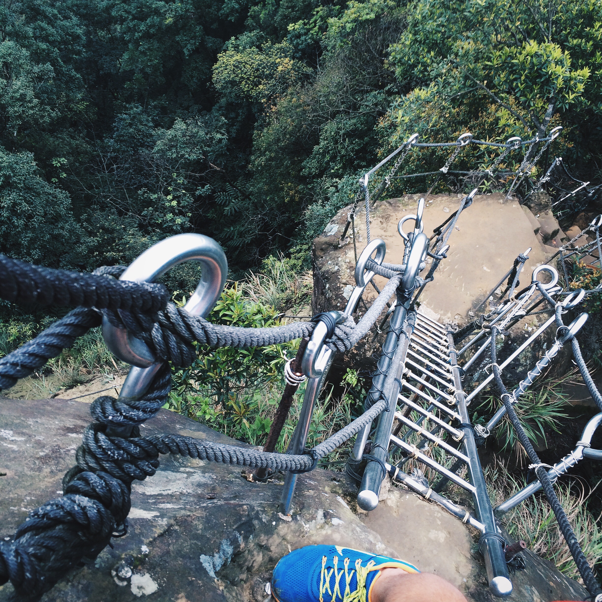
A quick look back before committing to the top of Xiaozi Peak

Looking back at Xiaozi Peak on a foggy day in Taiwan

A statue standard guard on the peak of Cimu Peak
If you have any questions please comment, or send me an e-mail. You will not regret taking the time to get out here and explore the crags. Also, I was surprised at the lack of people on the trails, it seems the attraction of launch lantern keeps most visitors in town. I was here in the heart of the weekend, with decent weather and I was one of maybe 12 out and about exploring this hikers + photographers paradise.